The field of surveying is an exciting industry, and new technologies are modernizing the way we do our job!
Many may think land surveyors mainly do fieldwork; however, each job comes with a split of time spent in the field and in the office. Whether in the field or in the office, Herrick & Salsbury, Inc. relies on a variety of modern technology to complete their work and produce final results for individual clients or to other professionals such as lawyers, wetland scientists, engineers, architects, and builders. Each project depends on high accuracy data. Advances in technology benefit our profession by attaining higher accuracy, paired with a need for the technology to allow the faster collection of that data.
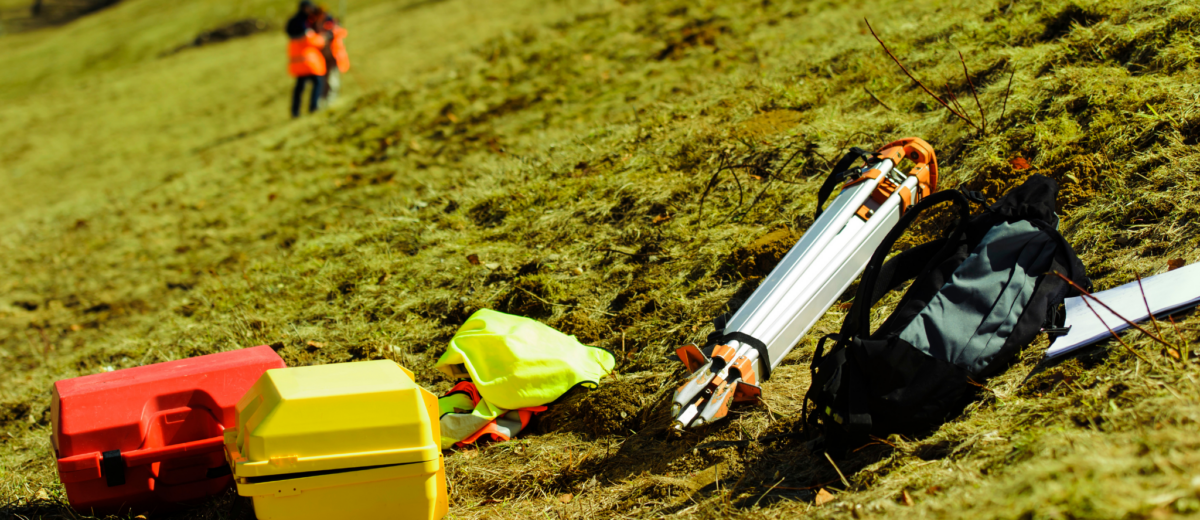
Here are a few of our most used gadgets in the field;
GPS
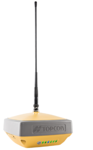
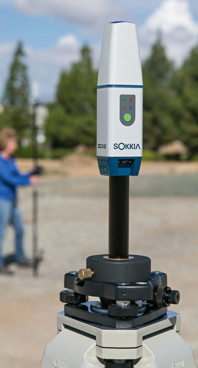
Global Positioning System (GPS) equipment allows us to collect data for bigger projects much faster than the traditional (total station) surveying methods because data collection does not depend on line-of-sight. In our office, we publish our GPS data on the grid system known as Maine East Zone, NAD83, but this data can be converted to other datums too. However, GPS needs open space above to return good data. In the heavy understory, like our Maine forests, we often have to use total stations to collect data where GPS cannot get solutions.
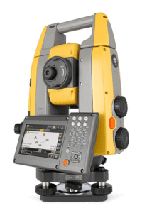
Total Stations
The total station we use, paired with a data collector, collects field points as X.Y coordinates. Sometimes these points are collected on an assumed datum, but more and more so are tired into a grid system such as Maine East Zone, NAD83. The total station has an EDM (electronic distance measurement) that reflects off a prism attached to a survey pole that the surveyor places over certain features they want to locate. This technology is great for smaller, detailed projects and for projects where tree cover is too thick for GPS data collection.
Metal Detectors
The metal detectors we use are specially designed for land surveying purposes and are referred to as magnetic locators. They are designed to detect ferrous metals in the ground. The metal detectors can detect below the surface, which is very useful when searching for boundary markers below grade and electrical or gas lines.
Computer Programs
At Herrick & Salsbury we utilize the Carlson Survey, a program that runs on top of the perhaps more commonly known AutoCad program to manage our field survey data and produce final survey plans for our clients. The programs allow for data manipulation, drawing, and overlay of a variety of data including aerial photos, scanned plans, and GIS layers. This platform also allows for easy sharing of data with other professionals who use drawing platforms for their work. As technology advances, these programs require increasingly powerful computers and gaming quality video cards.
At Herrick & Salsbury, Inc. it is important to us to run the latest versions of the Carlson Survey, and are constantly upgrading our computers to do so.
We also utilize Global Mapper, a GIS platform that displays data layers we can then import into Carlson Survey. Our office has come to depend on the use of Global Mapper in a high percentage of jobs we perform.
Honorable Mentions
Any surveyor would agree; sometimes, the best tools are simply the tried and true compass and measuring tape/wheel. Depending on the circumstance, we sometimes (oftentimes) pull out the old tape and compass. The nice thing about these pieces of equipment is that they are small, light, and easy to carry around in the woods. Also, there are no batteries to worry about, so they will always work. Advances in technology will never make these items obsolete.
In-Office Databases
In addition to our helpful gadgets, we also rely on an extensive database of information to assist project management:
- Registry of Deeds for the majority of our deed research:
- Large format printer for survey plan printing
- Old aerial photos and current aerial photos
- Maine GIS (Geographic Information System) website for various GIS layers
As technologies change and evolve the way we survey, the team at Herrick & Salsbury, Inc. continually improves how we do our job. Embracing the new and honoring the traditional way of surveying is a delicate balance we pride ourselves in maintaining.
If you require our surveying expertise, contact us today at 207-667-7370 or visit our website at HerrickandSalsbury.com.


